Surveying & GIS mapping
At Deep Builders Limited, we offer comprehensive surveying and GIS mapping services to support a wide range of construction projects. With our expertise and state-of-the-art technology, we provide accurate data collection, analysis, and visualization to facilitate informed decision-making and ensure the success of your project.
Our Survey & Mapping services include
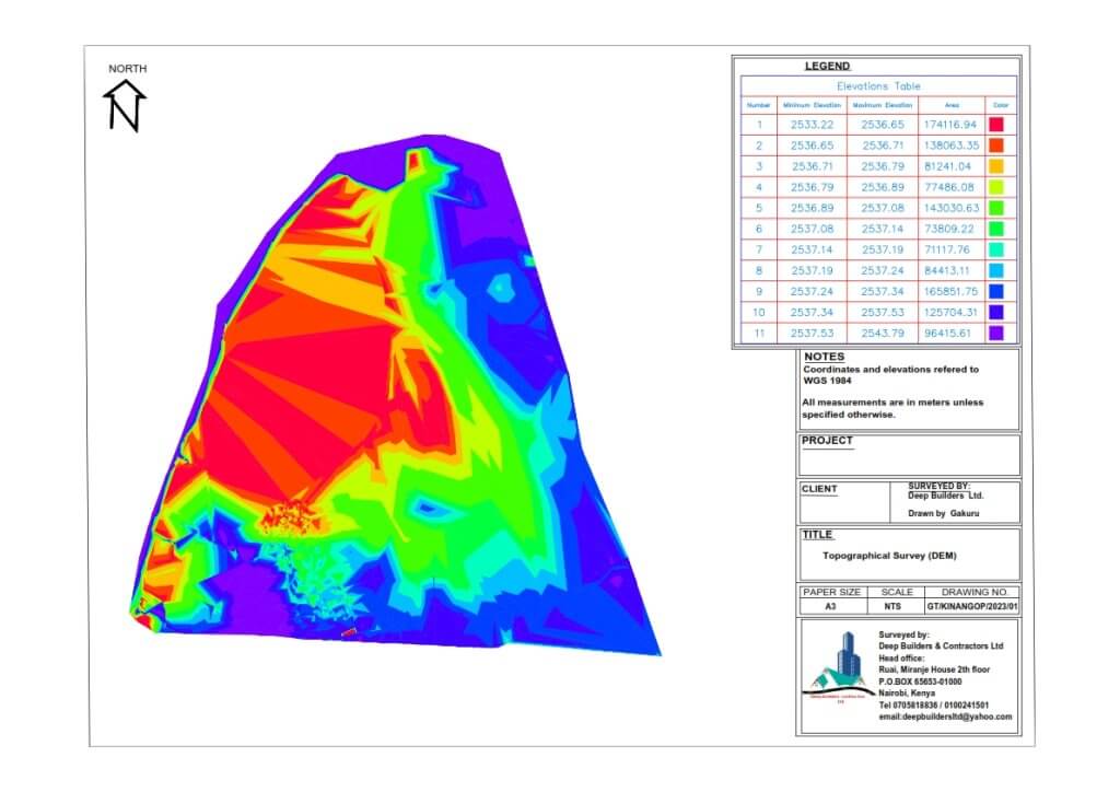
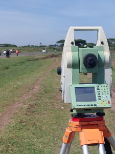
Topographic Surveys
We conduct detailed topographic surveys to accurately map the natural and man-made features of a site, including contours, elevations, trees, buildings, utilities, and other relevant information. This data serves as the foundation for effective project planning and design.
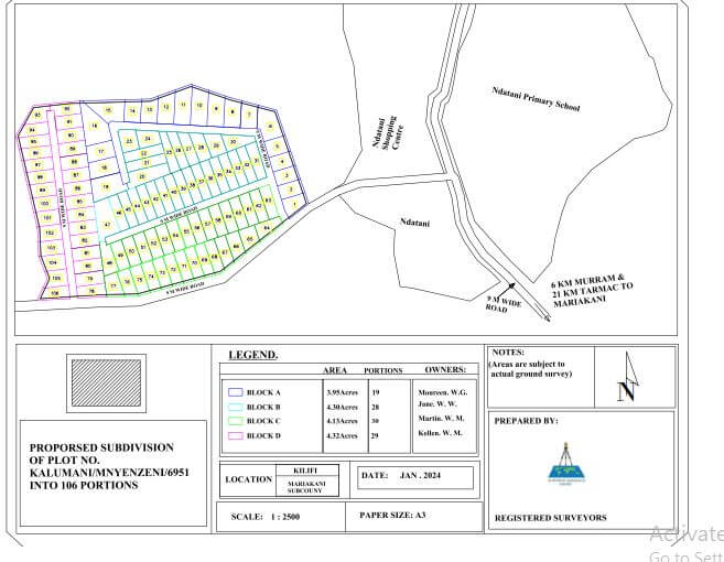
Boundary Surveys
Our boundary surveys establish the legal boundaries of a property, helping to resolve disputes, verify property lines, and ensure compliance with local regulations. We utilize advanced surveying techniques and equipment to deliver precise and reliable results.
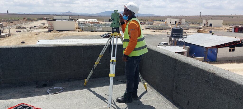
Construction Staking
We provide construction staking services to translate design plans into on-site markings, ensuring that buildings, roads, utilities, and other infrastructure are constructed according to specifications. Our team works closely with project stakeholders to ensure accurate placement and alignment.
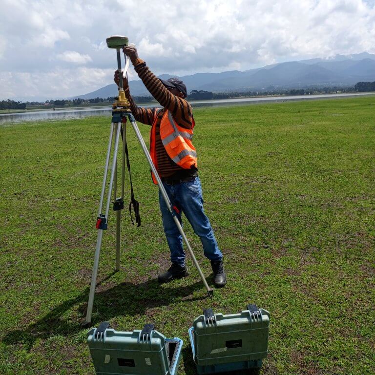
GIS Mapping and Analysis
Using Geographic Information Systems (GIS) technology, we collect, manage, analyze, and visualize spatial data to support informed decision-making throughout the project lifecycle. Our GIS mapping services help identify optimal site locations, assess environmental impacts, and optimize resource allocation.
Utility Mapping
We specialize in utility mapping to accurately locate and map underground utilities such as water lines, sewer lines, gas lines, and electrical cables. This information is critical for avoiding costly conflicts and ensuring the safety of construction operations.
Why Choose Deep Builders Limited for Surveying and GIS Mapping?
- Expertise: Our team consists of experienced surveyors and GIS specialists who are trained to deliver accurate and reliable results.
- Advanced Technology: We utilize cutting-edge surveying equipment and GIS software to ensure precision and efficiency in data collection and analysis.
- Customized Solutions: We tailor our surveying and GIS mapping services to meet the specific needs and requirements of each project, providing personalized solutions that deliver value.
- Commitment to Quality: We are committed to upholding the highest standards of quality, professionalism, and integrity in everything we do, ensuring the success of every project we undertake.
At Deep Builders Limited, we understand the importance of accurate surveying and GIS mapping in the construction industry. Whether you’re planning a new development, managing infrastructure projects, or conducting environmental assessments, you can trust us to provide the expertise and support you need to achieve your goals. Contact us today to learn more about our surveying and GIS mapping services and how we can help you succeed.